
Google has worked to refine the accuracy, visuals, and functionality of Google Earth over the years, making it the closest many of us will ever get to travel the world. But today Google Earth is getting its biggest update in years with the addition of one new layer: time.
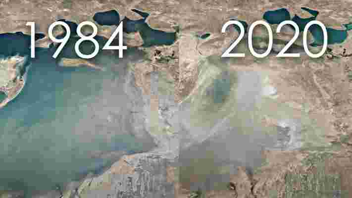
The app is launching a feature called Timelapse that lets you see how the planet is changing over the years, gathering millions of satellite images from 1984 to 2020. Some of these visuals are stunning — and terrifying, in the cases where they show our planet’s waning forests and global warming.
As you can imagine, creating a timelapse of the whole darn planet took an absolutely bonkers amount of processing power, involving tons of imagery from NASA’s Landsat and the European Union’s Copernicus programs. According to Google:
Google also worked with the Create Lab at Carnegie Mellon to identify five key themes of change visible in Google Earth: forest change , urban growth , warming temperatures , energy sources , and the planet’s fragile beauty . The company has a guided tour based upon each theme.
The company is hoping Timelapse provides users with a tangible sense of how our planet is changing over time, and why we need to protect it. Show, don’t tell, as they say.
To try out Timelapse for yourself, you can head on over to Google Earth here . If you don’t want to go around searching for key locations, the company has also amassed hundreds of Timelapses in this playlist .